hiking

San Vicente Redwoods Access Plan: Round 1

The Land Trust is accepting comments on the draft SVR access plan through Oct 10. Email access@landtrustsantacruz.org. Map courtesy Land Trust of Santa Cruz County.

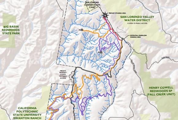
The first draft of the San Vicente Redwoods access plan is out, with good news for mountain bikers, hikers and equestrians—and a lot fewer dogs in its future than you might think.

Surviving Yosemite

Everyone stay cool! We took regular breaks at swimming holes on the Merced River.

Two adults, four kids, one VW camper and a very crowded national park.

Twin Oaks Tromp

Sky lupine on Twin Oaks Trail, a welcome sign of spring.

Sky lupine, blue-eyed grass, checkerbloom and a bazillion poppies are out on this favorite trail of mountain bikers and hikers alike.

Top 5 Rainy Season Hikes

A banana slug inches down a tree trunk in Nisene Marks State Park. Hilltromper photo.

The best places in Santa Cruz County to go hiking in wet weather.

Dog And Pony Show

What will the People say they want allowed at Cemex? Only time will tell.

Early results from Cemex access surveys suggest dogs and horses could become points of contention.

Five Fingers Loop

The striking markings of the bufflehead are a common sight on Five Fingers Loop. Photo by Bill Bouton via Wikimedia.

1.5 miles; 1 hour; easy
An easy foray into a corner of the park favored by avian life.

First Day Fun Photo Contest

Hello, 2014! Photo by Eric Miraglia.

This New Year's Day, eat a good breakfast, take some aspirin and document your First Day fun on Hilltromper.

Berry Creek Falls from Waddell Beach

The lower half of the Skyline-to-the-Sea Trail—basically a fire road between Waddell Beach and Berry Creek Falls — follows West Waddell Creek. Hilltromper photo.

12 miles RT; 600 ft elevation gain; 4-5 hours; moderate to strenuous
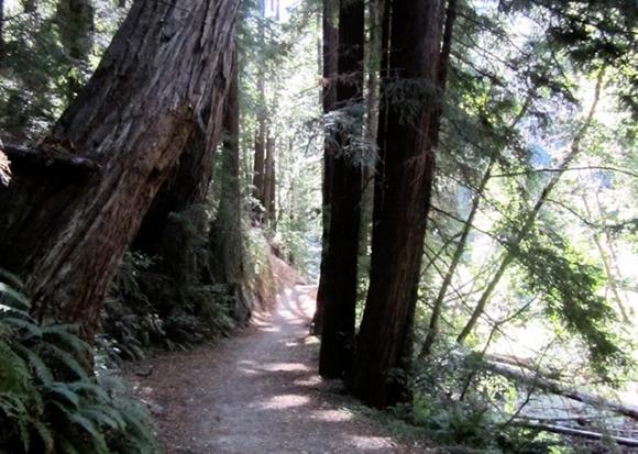
Skyline-to-the-Sea Trail from Waddell Beach to Berry Creek Falls Trail in Big Basin

Loch Lomond: Five Reasons to Go Now

Paddleboats are available at Loch Lomond for $5 an hour (two-hour minimum). Hilltromper photo.

It's the perfect time to acquaint yourself with this gem.

Emma McCrary Trail

2.2 miles; starting elevation 100 ft; max elevation 460 ft.

Pages